Foraging Behaviour Of Little Penguins Eudyptula Minorin an altered environment
Abstract: We studied the 3-dimensional foraging behavior of little penguins (Eudyptula Minor) breeding near dredged channels in Port Phillip Bay (Southern Australia) on an artificially built breakwater. During the 2006-2007 breeding period, breeding penguins were equipped with satellite trackers or recorders that recorded time-depth to measure foraging behaviour and dive locations. These data were compared with bathymetry.
The penguins were both demersal and mid-water divers. On 1 d trips, they reached a maximum distance of 13.8 km. Penguins have been recorded at locations with artificially constructed shipping canals. Their diving profiles suggest that they forage in these channels. The little penguins of this urban colony benefitted from human-induced changes in the terrestrial environment. However, their location puts them at risk for anthropogenic threats to their marine environment. This includes a large dredging project to deepen existing shipping channels.
INTRODUCTION
The anthropogenic alteration of nature is a common and obvious phenomenon. The negative impact of artificial habitat change on wildlife is well documented. There are many examples of the negative impact that artificial habitat changes have on wildlife, such as the reduction in species diversity caused by dam constructions (Pringle 2000, Gehrke et al. 2006). Nevertheless, some animal populations can adapt to and benefit from anthropogenic change, like peregrine fawns Falco Peregrinus nesting in high-rise buildings (Gilbert 1989; Cade & Bird, 1990).
Marine environments are more subtle than land-based ones, but the effects of human activity on them are still evident.
Coastal areas are particularly affected. The local impact of anthropogenic habitat modification can be easily assessed for sessile species such as seagrass, coral and algae (e.g. Richmond 1993, Ny- strom et al. 2000, Duarte (2002)), it is harder to determine the impact on marine animals that are mobile. The miniaturisation and reduction in size of remote monitoring devices, such as satellite transceivers and diving logs, provides increased opportunities for identifying how animals with high mobility use the marine environment.
The little penguin provides a good model to study local oceanic changes because it belongs to a short food chain. The little penguin has a restricted foraging area during the chick rearing phase.
The breeding season (Collins and others, 1999). 1999). At this stage, little penguins can only acquire local resources because they must return to their nests to feed their chicks regularly (Chiaradia and al. 2007). The central foraging behavior allows the data loggers to be attached and removed, allowing their behaviour at sea to be studied.
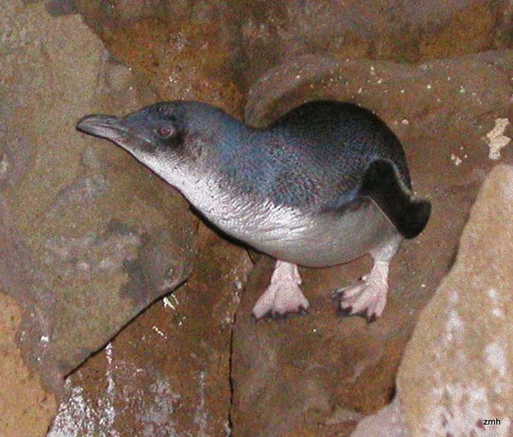
Little penguins are commonly found in many places, but they have suffered adversely from human activities and settlement. The main causes of decline in this species are introduced mammalian predators and habitat loss on Phillip Island, south-eastern Tasmania, New Zealand, and Otago Region in Australia (Dann, 1992a,b; Stevenson & Woehler, in press). There are also other potential threats that have an anthropogenic origin at sea. These include oil spills, overfishing, gillnets, the introduction of diseases into prey populations, and dredging (Dann 1992b). 2000, Goldsworthy et al. Stevenson & Woehler, 2001 (in press).
On a breakwater wall built at St Kilda in Melbourne, Australia, a colony of little Penguins lives. The colony is located near both marine and terrestrial urban development. The only little penguin colony in Port Phillip Bay. It is otherwise unsuitable to establish penguin populations because of a lack nesting sites and threats from terrestrial predators.
bance. Although habitat changes and other human-induced effects are widespread in this colony’s range of foraging, the population has increased to about 1000 individuals (Z. Hogg, unpubl. Since 1974, when the first breeding pair was discovered (Eades, 1975), data have been collected. The population growth can be attributed to food resources located in the northern Port Phillip Bay within 20 km from the colony. (Cullen et al.) 1996, but it is likely that the absence of predators in general also contributed to this. A fence will prevent roaming foxes and dogs from accessing the breakwater, which could decimate the colony.
In order to understand how little penguins utilize a highly altered marine habitat, we studied their 3-dimensional foraging behaviour at the St Kilda Colony during the breeding season of 2006-2007. We assessed, using satellite transmitters and depth recorders, whether penguins had adapted their feeding strategy to take advantage of bathymetric variations in the seafloor (including dredged channels).
MATERIALS and METHODS
Study site. St Kil- da in Melbourne, Australia was used to examine the diving behaviour of little penguins and their foraging zone occupation. 1)
During the breeding season of 2006-2007, November and December were monitored. The breeding status of penguins was determined by monitoring their nests three times per week -1. They were permanently identified with either a passive transponder, Trovan(r), or a flipper-band.
At St Kilda, penguins forage inside Port Phillip Bay (Cullen et al. 1996, a bay with a length of 1950 km 2 and an average depth between 13 m to 24 m. (although there are some deeper trenches near the entrance). There are several large shipping channels in the north, west and south of Port Phillip Bay. 1). The depth of the shipping channel is between 12-17m and its width ranges from 180-240m. Satellite trackers and depth-time recorders were deployed. Separate time-depth recorders and satellite tracking devices were used on penguins. We considered that the weight of both devices combined on a single bird would have been too much for a bird weighing 1 kg. One penguin, O53F, was equipped with both devices. The time-depth recorder was used during incubation.
Satellite transmitter for chick-guard.
The tracking of 13 birds was done using the platform transmitter terminals, KiwiSat 202 model by Sirtrack (60 x 31 x 20 mm cross-section area).
514 mm 2, weight in air 43g, antenna mounted at 60 degrees. Parallel, mini-time-depth recorders were also fitted on 14 penguins. Nine at the stage of egg incubation and five at the stage of chick-guard. Little penguins can spend up to three days at sea at a time during the egg-incubation stage and only one day during the chick guard phase. However, this duration can increase during poor breeding seasons. TDRs recorded data every 1 second in the depth range of 0-190m with a 12-bit accuracy and 0.1m resolution.
The waterproof tape Tesa(r), 4651 was used to attach all devices onto the feathers of the penguins (Wilson and al. 1997)
To minimise drag, place a strip of adhesive compound (Mastic, Denso) between the feathers and the device. To reduce friction and to prevent loosening, we applied a thin layer of adhesive compound (Mastic or Denso) in between the feathers. The penguin was removed of all devices and adhesives upon its return to colony following a foraging excursion. Each attachment and removal took about 5 minutes. The weight of the penguins was measured to 20 g accuracy using a spring scale (Pesola 42510) before and after instrumentation.
Data analysis. CLS Argos provided the locations of the penguins from the PTTs. The accuracy of the locations was also provided. These locations were plotted with Elsa Pro (CLS Argos 2005). In the analysis, only locations with accuracy of 1 km or better (Classes 1, 2, and 3) were considered. The R statistical program was used to filter the locations.
(R Development Core Team, 2005) using TimeTrack (Sumner, 2006), a custom-designed software package. TimeTrack is based on the algorithms described in Mc- Connell and colleagues. 1999 to filter out the locations that are a result of unreasonable speeds for one species. Bethge et al. reported a maximum swimming speed (3.3 ms -1) for Bethge et al. In 1997, no Class 1, 2, or 3 location was eliminated. The time-in-area was calculated using interpolation at intervals of 10 minutes between the predicted and actual locations. Time spent was assigned to grid-squares of 1 km 2 in 2003.
ArcView GIS 3.0 (Environmental Systems Research Institute 2004) was used to plot the bathymetry contours of Port Phillip Bay at 5 m intervals.
G Power analysis (Faul et al. was used to calculate the power of the sample size for describing the area of foraging at 95% confidence interval. The number of grid squares visited by each penguin was used to add the data sequentially in random order. We then calculated a curve that represents the cumulative increase in grid-squares with each additional penguin. The power of our sample was calculated by using the standard deviations and mean of the data.
Diving data was downloaded from TDRs, and analyzed (surface-alignment and dive detection) with IGOR Pro Version 5.0 (Wavemetrics). We adopted a diving threshold of 1m based on the relative accuracy.
The maximum depth reached in the bottom phase is 0.25 m/s . 2006, Ropert-Coudert et al. 2006). We filtered data to exclude dives that did not have a bottom phase (14,4%) for the analysis of these diving para- meters. They were mostly shallow dives (86.5% of them were less than PS5 m) and likely performed as part of a travel. Multi-Trace Dive was used to analyze dive shapes, excluding dives below 1 m. The dive profiles showed that demersal diving generally has a descent rate of 30.8 ms + 1 at depths up to 36 m.
All other statistical analyses were performed in SYS- TAT Version 10 SPSS. The statistical threshold for the analysis was set to 0.05, and values were presented as mean with 1 SD.
Satellite tracking
The 13 penguins equipped with PTTs performed either 1 or 2-day foraging trips, and the total unfiltered number of locations across all classes was 279 After filtering this down to 11 penguins, 98 locations were reduced to 98 Class 1, 2, or 3 locations. 10 performed one-day trips, and 1 (penguin o53F) performed two-day trips. Interpolating satellite data allowed us to calculate that the penguins occupied 222 grid-squares of 1 km 2 within Port Phillip Bay. The time spent in each grid square ranged between 1 and 668 minutes.
The little penguins that made 1 d trips to St Kilda, remained north of the bay and within 22 km from the colony. 2). From St Kilda, they headed south-westwards and included the shipping channels. The mean maximum distance to the colony for 1 day trips was 13.8 km +/- 4.1km. The power of our sample size of ten penguins at 95% confidence interval was 0.95 to represent the foraging areas within 1 d trips at the chick guard stage.
The penguins spent an average of 10.8% of the time on their 1st trip in the 1km 2 grid squares that contained the shipping channels, and 31.5% 2km from the northern shipping canal (i.e. The 1km 2 grid-squares that contain and are on either side of the shipping channel. The grid-squares covered 9.3 and
On 1 d trips, 22.5% of the grid-squares were visited. The penguin who performed a 2-day trip traveled in water 15m deep, reaching a distance of up to 51km from the colony.
Dive behavior
All penguins were retrieved after one or two trips. However, 3 penguins at the guarding stage and 1 penguin in the incubation phase had abandoned their nests. Nest abandonment is not related to the attachment of devices, as 57% of monitored nests were abandoned before chicks fledged, regardless of whether birds were part of the study. The reproductive success of the colony was low during the breeding season 2006-2007 (T. J. Preston, unpubl. data). The trip duration for dive loggers retrieved ranged from 1-11 d. There were 48 foraging days, and 32 690 dives by 10 birds in total (Table 1). Diving occurred exclusively during daylight hours, with the greatest depths at midday. Table 1 shows that, excluding dives below one metre, an individual’s total number of dives ranged between 422 and 6321. The maximum depth was recorded at 26.5 m, and the maximum duration of a dive was 79 seconds.
The average depth of the dives was 8.4 +/- 1.8m with a diving duration of 28.5 +/- 3.8s. Eighty-two percent of all dives (82.7%) were between 2-13 m in depth. 3). Only a little over half (44,3 +-4.6%) of all dives took place at a depth of +-1 m above the previous dive.
Table 1 shows that in dives where there was a bottom phase (84.6%), the bottom phase represented almost half of the dive time. (49.7+-7.3%) In 60,7 +- 7,0% of dives at least half the bottom phase was in the lowest depth quadrilateral. These dives either had flat bottoms, small undulations of 1 m or ragged shapes. 4).
It was not possible to determine definitively, as location and diving data were collected separately, which dives took place inside the shipping channels. The penguins studied in this study showed some dive profiles that were unusual. They included a phase of diving on a flat surface.
A rapid change in depth is sometimes followed but not always preceded by the onset of a sudden change (Fig. 5). As indicated by the low rates of descent and surrounding dives, many of these dives were mid-water, but 248 dives were demersal. 180 of these dives correspond to the depth profiles of the shipping channels (6-10 m outside channel, 11-17 m inside channel, 33 m between outside and within). These dives may have been performed by penguins leaving or entering the shipping channels. All penguins who made trips longer than 1 day could have done the remaining dives.
Several studies on penguin behaviour at the sea combine both location and dive information (e.g. Putz et al. 1998, Charrassin et al. 2004, Ryan et al. 2004, Sokolov et al. 2006, Mattern et al. This allows a direct correlation between the behaviour of the animal, and the bathymetry of the region. Unfortunately, these instruments are too big to use on small penguins. Our data on diving behaviour and location were therefore collected separately. Over a similar time period, we have no reason to think that penguins equipped with TDRs scavenged in a different area than those with PTTs. All PTT-bearing birds were in the same foraging area on 1-day trips, and the depths reached by TDRs were comparable to the depths at which PTT-bearing birds were foraging. The amount of time spent at sea determines how far penguins are able to travel. Those penguins who have been at sea longer than 1 day may have traveled further.
Attachment of external devices on pens
It is well known that the foraging ability of guins can be affected by their habitat (Wilson and al. 1986). The effects can be minimized by reducing the size of the device and placing it on the lower back (RopertCoudertetal. 2007). We used the smallest devices that we had available in the present study. The difference in the cross-sectional areas between TDRs (and PTTs) as well as the aerials (cf. Wilson et al. It is likely that the differences in diving abilities may have led to differences in foraging areas used by penguins equipped with PTTs as compared with those with TDRs. Aban-
During the 2006-2007 breeding season, the number of nests was high (57%). This is true for all breeding couples in the colony. The breeding success of the birds who carried devices was higher than the average colony (29.5%), TDR or PTT were carried by at- least one parent on a single trip: 38.0 % and 44.5% respectively.
The distribution of the tracked penguins from St Kilda at the chick guard stage was concentrated to the north of Port Phillip Bay. This is similar to the distribution of non-breeding penguins recorded by radio tracking. 1996). This area includes the northern shipping channels to the west of colony. This limited foraging area of little penguins that are caring for chicks is reflected by the low maximum distance travelled. It was slightly less than the value reported in Phillip Island for little penguins making 1 d trips. 1999).
In our study, 1 penguin who spent 2 days at sea and traveled between the shipping channels of the north and west used the west of Port Phillip Bay. Phillip Island is home to a small penguin population (Fig. The north and west of Port Phillip Bay are home to little penguins from Phillip Island (Fig. This suggests a high availability of prey and highlights the importance these areas have for both populations. The central part of Port Phillip Bay has also seen penguins, but they have not been identified as coming from St Kilda or Phillip Island (Port of Melbourne Corporation, 2007). If their foraging trips are not limited, we can expect little penguins to occasionally forage west of the bay.
Bethge et. al., 1997). Little penguins dive commonly to the middle of the water column. 1997, Chiaradia et al.
This species has been observed to dive in the water (RopertCoudert and co. 2006). The length and shape dive profiles of the penguins in this study suggested that they used both demersal and mid-water diving strategies (Fig. The table below shows the average depth of dives for penguins. The penguins dived within +-1 m (on average) of their previous dive on 44.3% occasions. This is similar to the rockhopper penguin Eudyptes chrysocome, which dives a combination of benthic- and pelagic-diving to within +-10% or the prior dive depth 53% of time. We decided that +-1 m would be a better threshold for this study, given the shallowness of Port Phillip Bay as well as the natural variations of the seafloor topography.
The average bottom phase duration for penguins in St Kilda is similar to the reported values for little demersal penguins diving from Penguin Island (Western Australia) (RopertCoudert and al. 2006). Little penguins of other colonies, which dive primarily in shallow or mid-water, spend less time at the bottom (Chiaradia and al. 2007). In the present study, penguins could cover a distance of 20 km (based on the average swimming speed Bethge and al. 1997). We saw that the depth profile changed frequently throughout the day. This made it difficult to differentiate between mid- and demersal dives. The little penguins of St Kilda eat anchovies exclusively ( Engraulis Australis ; A. Chiaradia unpubl. A. Chiara- dia unpubl. data). Anchovy are generally considered a pelagic species that lives in shallow waters, usually within the first 20 meters of the water column. 1993). Penguin species such as the Humboldt Spheniscus humboldti and African Spheniscus dmersus that feed on schooling pelagic fish, such as anchovy have been observed to capture prey from beneath, since the fish is easier to detect as a silhouette than from above or the side (Wilson & Duffy, 1986; Wilson et. al. This is the case with penguins in St Kilda, which feed almost exclusively on anchovy.
Exclusively on anchovy.
The dive profiles of the little penguins in St Kilda were unusual. They showed a rapid increase in depth at the bottom (Fig. 5). Unpublished accounts on these types of dives from Snares (T. Mattern, pers. comm.) Spheniscus Magellanicus (R. Wilson, pers. comm.) The characteristics of several dives in this study suggest that these dives were made mid-water. But benthic diving Yellow-Eyed Penguins and Megadyptes Antipodes are also known to perform dives with similar shapes (T. Mattern, pers.). comm.). The high-level dives and the sur-rounding dives are both performed at a consistent depth.
The descent rates of some of the unusual dives performed by little penguins during the current study indicate that they are demersal and likely reflect penguins responding to changes in seafloor topography. The simultaneous collection of data from each bird is required to pinpoint the exact location of these dives. However, this presents significant challenges for small animals. Nevertheless, based on our knowledge of bathymetry, we believe that the shipping channels would be the most likely location for these dives. Some of the recorded diving pro-files probably represent penguins diving in or out of channels. The penguins may use the three-dimensional structure of the shipping channel and the seafloor to catch their prey. This is similar to the foraging strategy suggested for the little Penguins on Penguin Island. 2006). The first report of anthropogenic features on the seafloor being used for hunting by a marine bird or mammal is a rare one.
The physical modifications made to the marine and terrestrial environments have been beneficial to this population of little penguins. However, their use of these modifications placed them close to a large settlement of humans and potential threats. The current proposal to dredge the shipping channels north and south of Port Phillip Bay is one such threat.
The proposed dredging of the shipping channels to increase their depth by about 3 m will be much more extensive than the regular dredging which has been carried out since the first channels were constructed in the 1860s. The dredging will have a major impact on the little penguins that live in the area. This is due to the increase of water turbidity. However, this effect can vary depending on the time and location. The dredging is expected to produce a large amount of suspended sediment, above 5 mg l -1, which will spread out over a 4 km x 18 km area, east of and immediately surrounding the shipping channels, in the northern part of Port Phillip Bay. (Port of Melbourne Corporation, 2007). This area is located between the penguin colonies and the main foraging area west of the shipping channel. It overlaps about 30% of the foraging range of penguins described in the study. Little penguins are not known to react to turbidity, but are visual predators. (Cannell and Cullen, 1998; Ropert-Coudert, et. al. It is unlikely that little penguins will be able forage in highly turbid areas within the suspended sediment plume.
The sediments are suspended in channels that originate on the seabed. It is unknown if the penguins will swim around or travel through the dense areas of the plume to reach the clearer foraging areas.
The recruitment biology and the spawning dynamics for the anchovy in Port Phillip Bay are still largely unknown. However, the north of Port Phillip Bay, which includes areas that will be affected by dredging, has been identified in multiple studies (Blackburn, 1950, Jenkins, 1986, Neira, & Tate, 1996). The peak spawning period is January, which occurs between September and March (Jenkins 1986), coincident with the planned dredging of the north of Port Phillip Bay (Port of Melbourne Corporation 2007, 2007). Anchovy’s foraging behavior may be affected as they are viewed as visual predators (Chiappa Carrara & Gallardo Cabello 1993). The physiological effects of suspended sediments on anchovy can cause high mortality rates, especially for eggs and larvae (Wilber & Clarke, 2001), resulting in a decrease in recruitment, and eventually a decline in population size. The reduction of cape anchovy Spheniscus demersus (Crawford & Dyer, 1995, Crawford 1998) has been linked to the failure of breeding of African penguins Spheniscus 2000). St Kilda’s little penguin colony may also experience similar levels of adult mortality and breeding failure if anchovies or alternative food sources are significantly reduced as a result dredging. Radio-tracking indicates that the population of more than 52 000 little penguins on Phillip Island could also be affected by channel dredging. They use Port Phillip Bay extensively in winter and spring. Anchovy, a key component of their diet, is also impacted by the channel dredging. 1992).
St Kilda’s little penguin colony appears to have adapted and benefitted from artificial environmental modifications in the past. Construction of a breakwater provided a nesting habitat, and shipping channels decreased the prey escape area. This adaptation to artificial environment modifications has put little penguins into a vulnerable position. Significant changes to their spatially restricted marine habitat such as proposed dredging could severely impact this population.
Acknowledgements. Earthcare St Kilda volunteers Z. Hogg, T. Shaw and E. Buik provided field assistance. M. Sumner was also a great help in analysing satellite data. D. Ball, from Primary Industries Research Victoria in Queenscliff, supplied the bathymetry for Port Phillip Bay. Toyota Australia, The Penguin Foundation, and Dan Costa provided funding for satellite tracking. BHP-Billiton provided funding for the diving study. Parks Victoria, the St Kilda Breakwater Wildlife Management Co-operative Area Committee and Parks Victoria granted permission to access the study site. The re-search was carried out under the animal ethics permit BSCI/2006/12 issued by the Monash University AEC and the wildlife permits 10003374 and 1003848 issued by the Department of Sustainability and Environment in Victoria. Image in Fig. Google Earth TM.